iGUIDE provides Facility Managers with the most practical way to generate accurate building information quickly, easily and securely to share with stakeholders to help them manage their dynamic workload.
Want to learn more? Book a call with one of our experts.
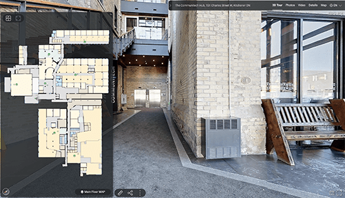
iGUIDE provides a quick and easy way to automate the creation of an immersive 3D walk-through and extensive property data. iGUIDE data capture enables you to easily map interior spaces, generate floor plans, document facility conditions and perform accurate measurements. iGUIDE is the most efficient system for Facility Managers to collaborate with all stakeholders in rapidly changing circumstances. Download our brochure on how iGUIDE can transform the way you manage facilities remotely.

Efficiently capture and draft 2D floor plans
The iGUIDE PLANIX Capture System is the fastest and most cost-effective way to capture and draft 2D floor plans with the DWG file export enabling capital asset planning, improvement of the facility and simplifying of work processes.
By utilizing iGUIDE DWG Floor Plans you can expect:
- Improved accuracy and better intersections over other formats
- A faster rate of capture: Measure properties in minutes, not hours
- Enhanced speed of delivery: Less than 48 hours instead of 5-10 days
- Less than half the cost of traditional methods
Why use iGUIDE?
360 Degree Images
3D Virtual Environment
Tags
Share
Measure Mode 1, 2 and 3
PDF, DXF, JPG, SVG Floor Plans
Try Out An iGUIDE Virtual Environment

Document conditions
Virtually visit and see the details required to build reports for repair and maintenance cost analysis and planning. Site visits can be reduced or even completely eliminated and communication can occur more rapidly between interested parties.
Market to potential tenants
Send potential tenants on a tour so they can get the information they need to understand if their endeavor will fit into the space. Whether it’s a not for profit, a start-up, or a hair salon, every business requires a space that meets their needs. Give them the ability to check this out on their own time and plan out the space before they move in.
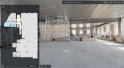
Monitor and share progress
Onscreen advanced measurements
Measure distances between arbitrary points in 3D space. Using only data from the iGUIDE camera and without a need to collect time-consuming 3D point clouds. Remotely plan and manage space. Whether it’s for personal use or for a contractor, Advanced Measurements can measure a space for several common everyday scenarios that span a broad range of industries

